Calanques National Park
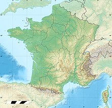
French national park in Bouches-du-RhôneCalanques National Park is a French national park located on the Mediterranean coast in Bouches-du-Rhône, Southern France. It was established in 2012 and extends over 520 km2 (201 sq mi), of which 85 km2 (33 sq mi) is land, while the remaining is marine area. It includes parts of the Massif des Calanques stretching between Marseille's southern arrondissements, Cassis and La Ciotat. Some of the park's best known features include the Calanque de Sormiou, Calanque de Morgiou, Calanque de Port-Miou, Calanque de Sugiton, Calanque d'en Vau and Cosquer Cave.
Read article
Top Questions
AI generatedMore questions
Nearby Places

Cosquer Cave
Cave and archaeological site in France

Mont Puget

Calanque de Sugiton
Inlet in France

Calanque de Morgiou
Inlet in France

Massif des Calanques
Mountains in Southern France
Aix-Marseille University Faculty of Sciences

9th arrondissement of Marseille
Municipal arrondissement in Provence-Alpes-Côte d'Azur, France

Centre International de Rencontres Mathématiques


